Flash back to early June 2007.
Just a couple weeks earlier I had left my stationary home in Florida and set off across the country in a small 16′ T@b trailer with Chris. My crazy adventure of full time RVing had just begun, fueled by biodiesel and the “anything is possible” energy of a new romance.
After a hectic couple of weeks of the typical newly-on-the-road chaos, we were now exploring on our own schedule.
We were keeping a steady pace, working our way from landmark to landmark on our maiden voyage together – trying to combine seeing as much of this great country as we could while still in a hurry to get to a wedding in California.
- Capulin Mountain. Check.
- Black Canyon of the Gunnison. Check.
- Colorado Monument. Check.
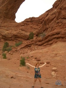
We were working our way west into the vast wilderness and abundance of public lands.
This particular morning nearly seven years ago, we left Arches National Park in Moab, UT and we didn’t have a specific plan for where we’d stop for the night. This had been Chris’s typical style before we met, but being a planner myself I was still getting used to embracing diving into the unknown.
No campgrounds or rest areas were serendipitously found, and as the day was drawing to a close with the sun setting in front of us, I was getting more than a little uneasy.
But then Chris mentioned that he thought we were surrounded by lands owned and managed by the Bureau of Land Management (BLM), and we could probably park nearby overnight with no worry.
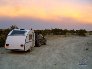
He pulled off Interstate 70, and tucked us in on a pull out down a side dirt road. It was our very first night boondocking in the wilds together.
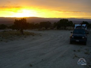
After parking, Chris got out to admire the amazing sunset. He kept cajoling me to come out and join him.
But I was too nervous.
I think I was expecting a bright neon ‘BLM Lands welcomes you, Cherie – rest well!‘ sign or something. Or maybe a park ranger greeting us with wine & cheese and personally inviting us to stay the night?
Or at the very least a ‘OK to Camp Here‘ sign.
But there was nothing to indicate that we were actually on public land.
All I could think was – what if we had pulled on to some rancher’s private road, and he was loading up his rifle now?
At the time, I was packing a Windows based smartphone with internet access. We had a horrendously slow very weak 1xRT signal, and I huddled over it missing my first in-the-wild sunset trying to find anything online that would tell me we were ok for the night.
But no maps I could access showed local BLM land boundaries.
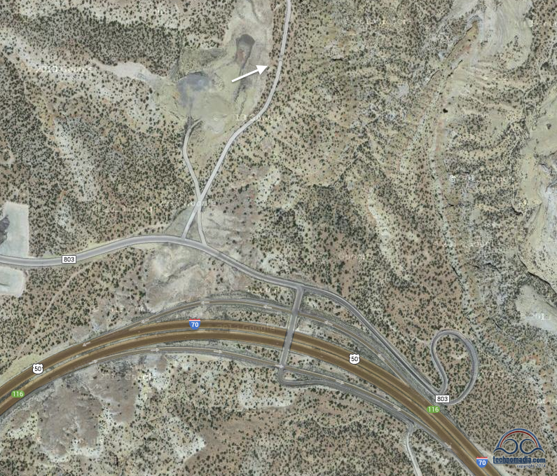
And there was no easy way to cross reference our current location on the rudimentary high level BLM maps I could pull up on their website.
Why isn’t there an app for this?!?
I could however confirm that the BLM did manage land in this general area. Well, most of Utah it seemed actually, and we were in Utah.
Learning that – I was able to get to sleep at last.
But I awoke at 5am with nightmares of a sheriff, a rancher, and a cow (don’t ask) banging on our door to rustle us out.
I shook Chris awake and told him we had to leave.
Now.
Flash forward a few years…
When we first came up with the idea for our Coverage? app a few years back (it overlays the four major cellular carrier’s data maps) – I immediately remembered the app I craved that first restless night, and wondered if we could do something similar with maps of publicly owned lands.
But after a bit of research – we put the idea on the back burner until we could either find time to manually create public land overlays, or perhaps some public domain source of data in a usable format.
One morning last summer I stumbled upon the National Atlas, a government run public domain source of cartographic information. One component of the National Atlas included the details and boundaries of federally operated public lands. They even explicitly invite people to make products out of the raw map data!
Eureka!!!
Just like that first boondocking early morning, I again shook Chris out of his slumber to start brainstorming turning that old app vision into a reality.
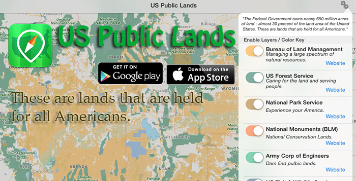
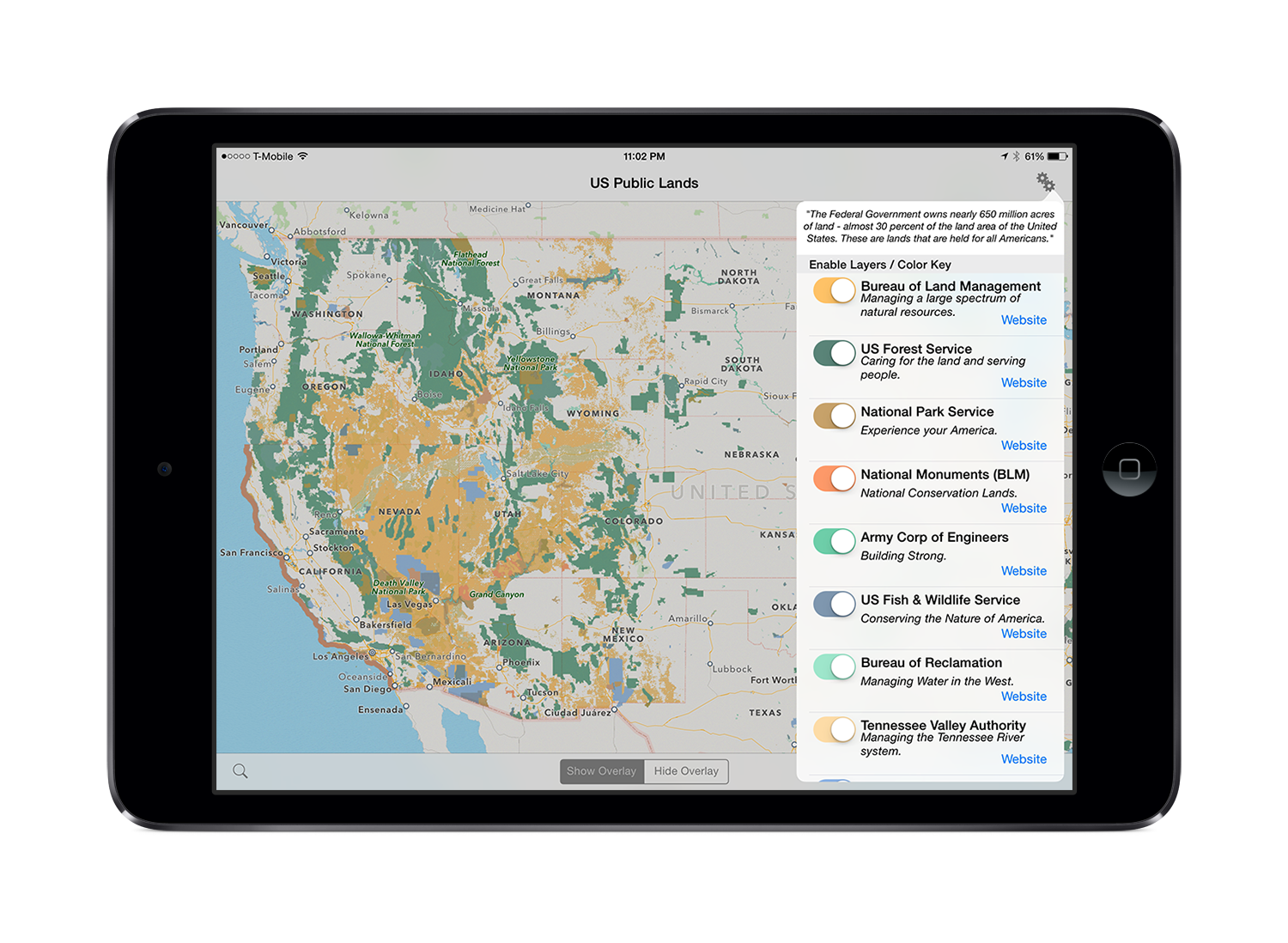
And now presenting our latest mobile app – ‘US Public Lands’
The US Federal Governments owns nearly 650 million acres of land – almost 30 percent of the land area of the United States.
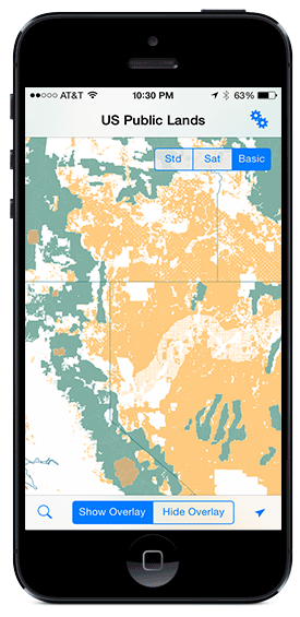 These are lands that are held for all Americans.
Up until now, there has been no quick & easy way to retrieve the boundaries of these properties without carrying physical maps, books, or slowly digging deep online.
Included in this app are on device (fully works offline), individually selectable & beautifully colored layers for all of the properties administered by the federal government that are more than 640 acres in size:
- Bureau of Land Management (BLM)
- US Forest Service (FS)
- National Park Service (NPS)
- BLM – National Monuments
- Army Corp of Engineers (ACOE)
- US Fish & Wildlife Service
- Bureau of Reclamation
- Tennessee Valley Authority
- Department of Defense (military bases & installations)
- Other (National Laboratories, Test Sites, etc…)
Get it now:
Key Benefits & Features
- Know which US agency owns and operates the land you’re on or are heading to. Use the Setting’s ‘gear’ to select which agencies you want displayed to create your own custom map. (Hint, the toggles are color coded to the color each layer is displayed in.)
- Links are provided to each agency’s website within the app, so that you can further your research as to what land use rules apply for each public land type – such as permits, fees, activities allowed, and limits of stay.
- Know where boundaries are between public lands and private lands.
- Map layers are stored on device – no internet connection required.
- Be sure to turn on the ‘Basic’ base map to see the US Public Land labels for each land area. This base map layer is also stored entirely on your device, and can be utilized if you do not have an internet connection or would like to conserve bandwidth.
- If you have an internet connection, you can utilize Apple’s standard and satellite view maps as well as the base layer underneath the public land overlays.
- A boondocker’s assistant – by turning on the Satellite view map, you can better scout out trails, roads and boondock camping locations within the boundaries of the public land resources. Quickly toggle between ‘Show’ and ‘Hide’ to more clearly see satellite images below.
- If you have GPS access on your device, click the ‘Locate Me’ arrow to show your present location – know what type of land you’re on right now!
- Built in search tool locates anything that Apple maps supports (requires internet access) – including cities, states, zip codes, addresses and points of interest. A pin is dropped at the search location.
- Universal App – iPhone, iPod Touch and iPad. iOS 7.1 and higher.
Get it now:
\
But US Public Lands isn’t just the guts of ‘Coverage?’ with our layers based upon the National Atlas database instead of cellular coverage maps.
US Public Lands has been newly written from the ground up, and is using completely new core technologies for overlaying and organizing data like this. It’s smoother, more advanced, and easily enables more features like satellite maps and a simple fully-offline base map.
And… it’s designed to be more portable too! This means that a version for Android and even a Mac Desktop release will be possible without as much fuss as it would have required trying to migrate the engine behind the original ‘Coverage?’ map overlays.
And you betcha, our Android development partner Hired Gun Software has already released an Android version of US Public Lands.
And… Now that we’ve designed a new core technology for enabling our mapping apps – we plan for the next release of ‘Coverage?’ to also take advantage of this new engine to gain a bunch of new features. Which means it too will become possible to be ported to Android.
Yup, Hired Guns is on that too. Yay!
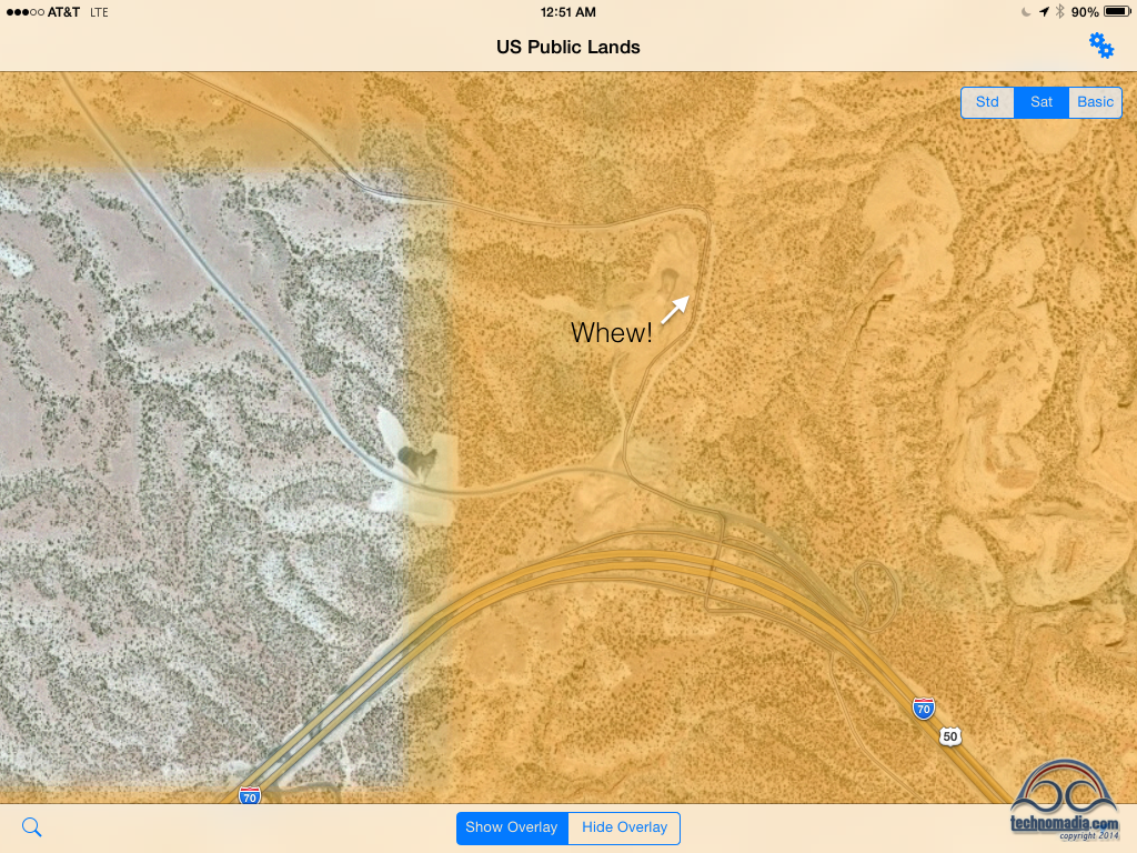
So nearly 7 years later, I can finally rest well knowing – yes indeed, we were on BLM land that restless night long ago.
Barely.
I’ll let Chris sleep in next time.

So have you merged the coverage and BLM? That is my dream app and I would pay for it. I want to go in the road do badly but have to work another 10 years. I can work remotely but internet has been a huge problem. So has the price of campgrounds while still pay uk nt fir a brick and mortar
No we haven’t, and no intentions to. They have different audiences.
Hi Cherie and Chris, I own a phone, a tablet and a computer… do I have to buy the App three times to have it on all three?
Thank you in advance for your answer and safe travels.
Jean
If your phone and tablet are on the same App Store account, you only purchase once. Just like all apps you own. This app is not available for desktop.
Installed your app on my iPhone 6 and it seems to work quite well. I then installed it on my 2nd gen iPad and was dissapointed to see that the mapping was almost useless. Can’t zoom in much beyond the state level. Certainly not enough to be usable. I’m at iOS 9.2.1. Am I missing something?
The maps are the same resolution on both devices – should work the same.
Unfortunately, no. I can send you a couple of screen snaps if that will help. I am suspecting something in the 2nd gen hardware may not be compatible.
Love your content BTW. Keep up the good work 🙂
Just pulled out our iPad Mini 1 (same as a 2nd Gen iPad), and can zoom in as far as we desire.
Happy travels to you both and congrats on this app release. As you know, I could have used something like this when I was a technomad! I instead relied on chatting locals up, finding land offices, and asking if they had dispersed camping.
PS worth stating… knowing that you are public lands does NOT mean you are allowed to camp there. Example: public BLM lands within a 15-20 mile radius around Moab and other heavily used areas. They shut down dispersed camping ’cause the land was loved to death… IE health concerns. Heck, Burning Man would be another example. 🙂
PPS even if you ARE allowed to camp there, it doesn’t mean you won’t be woken up by police or others. We had police wake us up in a Texas rest area (overnight stays allowed) just to make sure we weren’t up to no good and/or the car was abandoned. Had rednecks drop by in other spots too; no troubles… we were apparently camped in their party spot and they honked their horns to let us know. 🙂
Great advice – nothing can replace double checking local details and specific rules. Most of the time, if you track down a ranger they are happy to share advice and tips on great boondocking spots.
Cheers,
– Chris
We are buying an Oliver 22 this summer and are planning on boondocking the majority of the time. This app will be a tremendous help. I know you guys had an Oliver 17 and imagine my surprise when I saw that you had developed this app.
This is brilliant!
Just graduated to my first smartphone (can you believe it?) three weeks ago and still getting used to it. Your android version will be the first app I (attempt to) download! Thanks Chris and Cherie!!!
As for federal public lands here in Canada – we do have it – probably more square miles of it than in all of the US – we call it Crown Land and mostly its way up north and without roads into it so not nearly as RV-friendly.
If you ever stumble across a good source for map data of the Crown Lands, let us know. A Canadian version sure would be interesting…
– Chris
So, assuming there is no one around at the moment, how “do” you know if it is OK to boondock in place?
Once you identify what type of land you’re on or are heading to, look up the land use rules for that specific area – or stop in the local management office to talk with a ranger.. or use one of the many free campsite websites or resources out there for specific tips.
What a fantastic app this is. I have been looking for one like this for a long time. Great job! We always use the Maps app on our iPad to search the area in front of us for places to pull over or maybe stop for a few days. Now we will be able to know, without having to hunt down the information, that it is okay to camp there and not worry about the proverbial knock on our door, during the night, telling us we have to leave.
We have a 2005 40′ Monaco Dynasty that we affectionately named BAM (Big Ass Motorhome) so researching where we are going is necessary. In your blog, where I found the link for this great app, you told the story about breaking down with your air problems and the expenses you incurred. So I want to share with you how our day went yesterday, where we too had an expensive misadventure. The exhaust tip on BAM came loose and Kendra noticed it when we pulled in for fuel. I lifted it back up and pushed it in place as we were just going another 2 miles to the restaurant/truck stop we were staying for the night. The next morning we took our car and went on some errands and on returning that night, noticed the now missing exhaust tip. We drove the 2 mile section of road and never found it. We are staying in the Fresno California area waiting for 2 grand-babies to enter into this wonderful life, one from a daughter and the other from a daughter-in-law, so we searched for another place to park.
We have now put 20 miles on BAM since we noticed the missing exhaust pipe decorative tip and we pulled into a shop to have the transmission serviced. I was talking to the technician, while standing at the engine compartment, when I noticed the rear electronic run box cover had fallen down and was jammed in an area where the HOT exhaust pipe was pointing straight at it. Unfortunately, the exhaust had found a new path to take as it was now not deflected down by the pretty decorative, but actually functional, exhaust tip. ‘Dad-gum-it’, the cover was now melted and deformed and turned into a pile of useless plastic-fiber type material. Well, the rear cap of BAM is only 5″ away from that HOT exhaust pipe and I knew if we were to drive the distance we were planning, we would melt and deform the rear portion of BAM. Not a good thing!
We drove to Paul Everts RV Country in Fresno, only 1 mile away, ordered the new parts and asked if we could stay/park on their property until the parts came in, because of the possible damage to BAM if we were to continue driving him. It is going to be 7 to 10 working days before the new exhaust tip and the cover will come in and they have graciously allowed us to hook up to their power and water, with a dump staton on site. Now granted, this is a situation where driving BAM could cause extreme damage so our need was evaluated by the general manager, who approved our stay. I highly recommend this business to others in need of service and/or repairs. Their website is http://www.rvcountry.com and the address is 3633 S. Maple, Fresno, California. The parts manager, Stacy, was instrumental in helping us during this time of our need, in both locating the parts and getting permission for our extended stay.
The total cost of our mis-adventure is $550 for the exhaust tip, $200 for the door. On hindsight, I should have tightened the exhaust tip when I found it loose and made sure the little door was properly secured, that is an expensive lesson.
Now, circling the wagon back around so-to-speak, I want to thank you for the wonderful, very useful, app and all the hard work that I know goes into your efforts. When you create an app or a book, we just buy it because we know that it will be useful and valuable to put in our arsenal of needed information. Unlike some apps I have purchased that didn’t pan out the way I had hoped, yours always out preform my expectations. Thanks again for all that you do. We hope to cross paths with you sometime in our travels and share a campfire, stories and a glass of wine…or two. Take care and happy travels.
Ken & Kendra
Thanks guys! Love your feedback, and sharing of your own story. Glad you had a good experience, and are back on the road.
By the way, we’d love it if you left your review in the App Store or Google Play so that others considering downloading it will know you loved it! Thanks!
“When you create an app or a book, we just buy it because we know that it will be useful and valuable to put in our arsenal of needed information.”
*******
I kinda think that, too.
As a Canadian from QuÁ©bec, I’m always amazed, how structured is the area where boon docking is allowed. When its a wild open area, not owned by the Bureau of Land Management… if your careful of leaving the site as you took it, why would the “Potential Owner” be frustrated to tolerate a visitor? My Golly! Life is so much easier with a touch of tolerance.
Like you, I do not like commercial camping grounds where people are parked one on another. For years, I’ve been travelling in QuÁ©bec and the Maritimes and never ask myself: «Is this land owned by my Government?» With permission (and sometimes not) I camped on farm land without problem… they sometimes graciously offer to hock-up for water and electricity. I’ve NEVER been asked to leave by a belligerent land Lord.
Sharing makes it so much fun to travel. Two worlds so close but in a sense so far. However, being respectful of your culture, I will buy your app when I decide to carefully visit your country in the future.
SL
I’m not sure the culture is all that different – there are incredibly welcoming people all over the USA, and we too have been invited to camp for free on many farms and ranches, sometimes by complete strangers.
It is just helpful to have a bit of extra information in advance to know whether or not a landlord might be lurking.
I wonder if the raw data exists so that we could make an app like ‘US Public Lands’ for Canada – I am sure that would be a very useful tool for many.
Cheers!
– Chris
Love the idea of the app… but my iPad is jailbroken, so I’m not yet able to upgrade to iOS 7.1. Is there anything about the app that specifically requires 7.1?
If not, it seems that you could significantly broaden your user base by allowing us users with recent (but not current) iOS versions to purchase and install it. 🙂
Yes… there are features that are dependent on 7.1 functions. Based on user stats of other apps, we think ‘significantly broaden’ would be a gross overstatement. 🙂 Most users upgrade pretty quickly.
Fair enough… I’m actually quite amazed by the stats Chris posted below. Much higher user base on 7.1 than I would have expected! Alas, I guess I”m out of luck on my iPad until I upgrade, though I was pleased to see a recent release for Android as well. 🙂
Cheers,
Taylor
Hi Taylor —
To give you some context…
Our app ‘State Lines’ still supports all the way back to iOS 4.3, and the usage metrics for the past week show over 90% of the users are on iOS 7.1.
Our app ‘Coverage?’ supports back to iOS 5.0, and the metrics for last week show 80% of users on iOS 7.1, and only a fraction of a percentage using anything before iOS 7.0. Interestingly – I see one report for iOS 8.0 in the logs. *grin*
This is one of the greatest things about the Apple ecosystem – since upgrades are free and easy and support even devices many years old, the vast bulk of users are always on the latest OS — making it easy for developers to embrace new features.
I totally appreciate some of the cool things that jailbreaking enables, but it does come with a few downsides too.
Cheers,
– Chris
Wow, *much* higher than I would have expected! Anyway, thanks for taking the time to respond… and for working with Hired Guns to make an Android version available so quickly. 😉
For anyone subscribed by e-mail to this comment thread waiting to hear the news… US Public Lands is now available on Android!
Link: https://play.google.com/store/apps/details?id=com.twostepsbeyond.uspubliclands
Enjoy 🙂 And thank you to our development partner, Hired Guns Software, for getting this out so quickly!
We are just about to leave the NE and fulltime heading West. This APP is just what we needed.
Congrats on the successful RVillage too.
Thank you! I have been waiting for this! Good luck, I hope you sell millions of these apps! I will tell ALL my RVing friends.
Ol Ponts
Consider adding other types of public lands. Good example, and it would fill in lots of white space in Arizona, are the Public Trust lands. Primarily in the western states they offer places that can be used, very similar to the BLM setup. Usage varies by state. Here in Colorado very different than Arizona.
If we can find a similar source of data for non-Federal public lands, we’ll definitely be open to adding them. Do you know of any such source?
Do you show the legal description (Section, Township and Range)? I work for a major state land management agency and the problem I see people having with our maps is the GPSs designed for highway use don’t have that info or show a lot of the forest roads so people can’t tell if they are on State land or on private land. We welcome campers but many of the private landowners do not. If you provide legals it might unlock a lot more maps for people, especially since property ownership tends to be by section or fractions thereof. And yes, one section equals one square mile equals 640 acres. (or pretty close anyway given the inaccuracy of surveying technology back when they laid out the grid in the late 1800’s).
No Apple stuff here but I’m looking forward to the Android app.
Hi Jenny —
We only have the level of detail that is available from the USGS National Atlas. I know that the USGS is scheduled to release more granular data sometime later this year – when they do we will look into incorporating it. If you know of any other public domain sources for more detailed information, please do let us know.
Once you try the Android app – let us know what other ideas you have.
Cheers,
– Chris
Just got your app. So cool!!! I was going to buy your State Lines app at the same time but I couldn’t tell if that app is for I-Pad as well as I-Phone. I don’t have an I-Phone but use my I-Pad all the time.
Could you let me know one way or the other?
Thanks and Congrats to you both on a job well done!!!
Thanks for getting the app. State Lines is currently designed for iPhone, but it will run on an iPad, just at iPhone resolution.
Great app idea for RVers and any kind of campers! Glad to hear this and ‘Coverage?’ will be hitting the Google Play store soon too!
Thank you very much for the app. Bought it, love it. Thank you.
Great idea for an app, guess ill have to give in and buy a used iphone (windows 8 currently). I ride dual sport motorcycles and like to ride and camp, this app will help a lot.
Unfortunately, not as many apps coming out on Windows phones. We will very soon have an Android version too, so that’s another option. Thanks!
Thank you thank you thank you!!!!!
And thank you 🙂
I just bought the app and I can’t wait to use it. Cherie, I’m cracking up at your story of the first time you boondocked with Chris, but I had EXACTLY the same reaction the first time we boondocked. I kept looking for a sign too! This is a fantastic idea for an app and I’m so glad you developed it!!
Thanks Jen! And thanks for the happy hour breaks while we were developing this app during our last visit 🙂 Perhaps our next meet up will be while boondocking somewhere awesome that this app helped us find.
GREAT Ap; but will there be & when is drois coming; there r more droid users now?
PS. LUV ur blog!!!
Yup.. the Android version is nearing completion. Hoping to announce it soon!
You guys are genius!
Awww… blush. Thanks!
I wanted to download your US Public Lands app but I am to old. The app store will not download the app to my 1st generation I Pad.
Sorry
Yup.. sorry, the app requires iOS 7.1 to accomplish some of the mapping techniques we’re using.
Cool app. What are the checkerboard patterns, especially along I-80 in Wyoming? Thanks!
Those are the public land boundaries… in some locations, the government only owns every other square X miles in a checkerboard pattern.
Interesting. No wonder it’s so difficult knowing whether you’re on BLM land or not. Great app and very responsive to re-sizing.
Here I am thinking you guys were off the grid for few days, BOOM a new exciting app! Awesomeness!
Well.. we were off-grid. Hyperfocused on getting this app done 🙂
This is cool indeed! I love the The National Map, the National Atlas sites and the forest service maps, heck I’ve been using some of the online map collections just this past few weeks to scout out cool new secret tent camping spots for my old gang, but Its often a huge bear to find info about National Forests boundaries and such. Looking forward to the Android Version. I’d use it a lot. I don’t have any apple products though.
Android should be soon.. keep your eyes pealed. We’ll announce it as soon as it’s available.
Looks great! Will there be an Android version?
As advertised 🙂 Hopefully pretty soon. We’ll make an announcement.
That sounds so awesome but sadly I will have to wait for the android version. We’re leaving at the end of June for 3 or 4 months. Too soon? (keeping my fingers crossed)
Our Android developer is making quick progress, so I sincerely hope you’ll have the app on your device long before your departure 🙂
Very Cool – Just downloaded mine. Thanks!!
Thank you!
Absolutely Awesome!
I’ve tried finding an app with some of these abilities but was never successful. Now it’s available but with even more capability that I’d have imagined.
Thanks for doing such a great! (2 thumbs up)
Fantastic.. glad it hits the sweet spot for you!
Absolutely Awesome!
I’ve wondered why I could never find an app with some of this capability. Now it’s here, and with considerably more abilities than I’d have thought it could have.
Thanks and what a great job!
You guys are on fire! Husband is into GIS, so I think he’ll like it, too.
Thanks.. hope he enjoy it!
Our new blog available also. RVillage is awesome!!!
Thanks.. glad you are enjoying it!
Looking forward to the android version!
Great! A bit late for us, unfortunately, but will definitely try it out next time we are on the road.
One of these days I need to get around to updating our all-time most popular blog post, on dispersed camping, here:
http://ourodyssey.blogspot.com/2008/05/dispersed-camping-on-public-lands.html
Whenever I do, I will link to this post. In the meantime, perhaps you’d like to leave a comment over there with a link instead.
-Sean
Thanks so much Sean! I just left a comment on the post. Appreciate that 🙂
This sounds like an awesome app! I’m downloading it while typing. I think it will be fantastic for that “big out west trip” that I’m probably 3 years away from taking. I like that you’ve included a lot of off-line capability, as I currently don’t travel much, so don’t have cellular data. Looking forward to becoming familiar with it.
Thanks… being useful offline is very important to us, and glad the efforts are appreciated 🙂
You guys ROCK!!! Thanks for this awesome new resource. Grabbing for my iPad and can’t wait to get this AND Coverage when the Android versions are released.
Thanks Jill!
Yay!!! Just in time for planning our Great Out West Trek. Your announcement could not have come at a better time. Thank you for your hard work on this…it’s going to make our trip much easier to complete.
Glad we timed it well.. let us know how the app performs for your trip!
Great app – we will definitely add it to our arsenal! And boy have you “come a long way baby” since that first boondocking experience!
No kidding.. it was fun to remember that first night and realize just how much I’ve adapted to life on the road.
Just bought the app. It looks great. Even though there is not much Federal land in the East, I already found some new to me Nat’l Wildlife Refuges for my photography. Good job!
Awesome.. hope you capture some great shots!
Got it! Cool. thx…
— jc
Thanks.. and enjoy!
LOVE the new app! I was a little confused initially about what the blue areas were because there was no color match & then I saw your instructions to go to Basic. Perfect…we would not want to–nor could we probably–go to some of those places…Hanford Site…Yakima Firing Range. Brilliant app–thank you!
Glad ya figured it out 🙂 Another hint… the layers are color coded, and the key is in the ‘Settings’ toggle switches. The colors match.
Wow … this is a biggie!. I can’t wait for the Android version!! And yes, I’m willing to pay for it!!! Job well done!!!! 🙂
The Android version should be out soon.. keep your eyes pealed 🙂
AWESOME!!! I’ve resisted buying those big bulky paper DeLorme Atlases because everything else I own is in ebook or app form. Just bought your new app now and can’t wait to put it to use later this summer when I get out West! Thanks guys for another excellent tool to add to our nomadic arsenal!
Sweet… let us know how it works out. And hope that our paths finally cross out west out there.. somewhere! It’s overdue!