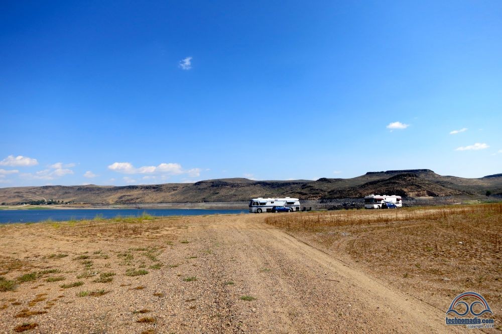
So, I promised I would write about how we found our awesome wild camping location along Magic Reservoir in Idaho a few weeks ago.
There are tons of methods for finding boondocking locations, and finding a great location really comes down to how much time and effort you’re willing to put into the search.
There are several styles of boondocking out there for RVers, including ‘black top’ boondocking at retail parking lots and rest areas and dry camping in designated campsites. This post in particular is about a particular style of boondocking we like to call ‘wild camping’ – dispersed camping on public lands.
Many BLM (Bureau of Land Management) and National Forest lands allow camping for up to 14 days at a time.
And there are tons of awesome resources from information on known boondocking sites (what we call ‘the low hanging fruit’), so we’re not going to try to replicate it. Instead, here’s some of our favorites if you’d like to learn more:
- Campendium – a fantastic curated lists of camping locations with end user reviews, both for pay and free boondocking sites.
- Freecampsites.Net – a crowdsourced website listing free or cheap places to camp, run by some fellow full timers
- Days End Directory – Available the Escapee’s members, this is a highly regarded directory to boondocking locations. (Note, Escapee’s is running a special until the end of October to join for just $29.95, and then the Days End Directory is an additional $10.)
- Back To Boondocking Basics — 8 Steps To Get You Into The Wild – Nina & Paul of WheelingIt’s guide to boondocking – from how they find their spots to managing water and electricity.
- OurOdyssey’s Dispersed Camping Post – Former full time RVers (and now boat nomads) Sean & Louise posted a very comprehensive article about finding boondocking locations, and lists a lot of the rules and exceptions. Well worth a read and bookmarking.
On our last boondocking adventure however, we used a slightly different method than discussed in the above posts. Sometimes you just want to go somewhere not well known or overshared on social media.
We don’t plan too far in advance in our routing and don’t like spending tons of time on research to find our next stopping point. Routing by serendipity works rather well for us, but sometimes we need to supplement a bit of mobile technology to aide the process.
Here’s how we found Magic Reservoir:
Step 1: Start with US Public Lands
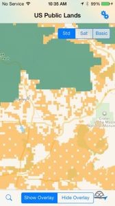
We wrote an app earlier this year called US Public Lands (available for iOS and Android) that displays the national land boundaries on mobile devices. One of its many uses is helping find where BLM (Bureau of Land Management) and USFS (US Forest Service) land is, to help in furthering your research for boondocking locations. (Yup, we write apps to solve needs we find in our travels!)
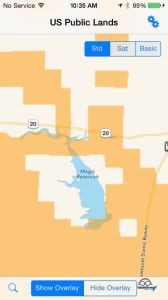
Since we were in Arco, ID and desiring a boondocking location as our next stop – we looked ahead on our potential routing about 100-150 miles west, our comfortable distance for a day’s drive.
We set US Public Land’s to display only BLM and USFS land using the ‘Settings’ pull down, as those are the agencies who generally allow camping for up to 14 days.
Since we love water views, we looked for land along water masses. Magic Reservoir stood out – perfectly along our route and not too far off major roads. And there were patches of BLM land all around it.
That became our primary target to research further.
Step 2: Google it!
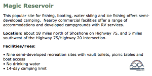
Knowing that many others before us have enjoyed our public lands, we did a web search for ‘Magic Reservoir’ and the words ‘Boondocking’ and ‘Camping’ to see what came up. Of course, if you do that now our own posts about the experience will come up too.
The first site we found was of course the BLM’s website on Magic Reservoir. And the only information we could gather on their website was that there were 9 semi-developed camping locations, and dispersed camping was indeed allowed. Most other websites we found pretty much just referenced the same information.
We checked FreeCampsites.net and the Days End Directory, and there were no entries to be found. We also checked in with the AllStays app, and discovered there was at least one commercial campground in the area, and one BLM campground. That gave us confidence that road were likely RV friendly, and there were RV park options if we didn’t succeed in reaching a boondocking location.
Step 3: Satellite Maps!
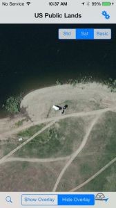
Our next step would be utilizing satellite maps to discover just where these camping locations might be. US Public Lands allows us to display the device’s satellite maps underneath the land boundary maps, which aids in the process. We also switched to Google’s satellite maps (since we use iPhones, the underlaying maps in US Public Lands is Apple Maps), which were taken at different times of the year. This increased the amount of the information we could gather.
We scouted around looking for signs of campers present when the satellite image was taken. And voila.. RVs parked along the reservoir.
This confirmed both the location of a possible campsites, and that the road to that location – at least at one time – was accessible to larger RVs.
Comparing two different satellite maps also showed us that the reservoir levels vary quite a bit and that some of the land masses might be underwater.
Satellite maps are awesome tools in virtually scouting our camping locations!
And of course, we also brought up the location in our app Coverage? to know what our connectivity would be like for Verizon & AT&T. It would be marginal, which was fine by us.
Step 4: Route to It!
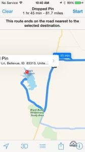
We then used Google Maps and Apple Maps to find potential routes to the locations by placing a pin at the location of where RVs were in the satellite images. Both maps gave us some.. umm.. interesting.. and conflicted routing. So we knew not to trust the specific directions as we got closer.
But it at least got us to the main road to the nearest town of West Magic. Worst case, we’d be able to inquire with locals for tips on where to head.
We also used Google Street View to try to scope out some of the roads and make sure there were decent odds they’d be passable for a motorhome.
One route in particular by Google had us navigating a steep and twisty road down into the reservoir, then over the dam. Once our crew surveyed the land by foot on one of our evening walks, we nicknamed it ‘Eeep Road’ (for the sound we’d all be making had we driven it) and were mighty glad we didn’t follow directions blindly.
Step 5: Using Instincts!
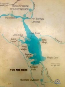
With enough knowledge that RVs had gone before us, and a general target for the direction we needed to head – we left the rest to serendipity and using our instincts.
As we had our boondocking virgin friends following behind us, we were even more cautious to make sure they had a positive experience.
We caravanned out together, used the AllStays app to target a nearby rest stop on the way to use as a convergence point and final navigation pow-wow before adventuring off the beaten path.
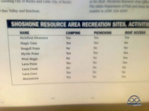
Once we turned down the road towards West Magic, there was a BLM information sign that gave us the locations of semi developed camp areas along the reservoir. Maybe one day this sort of information will make it to their website, but it seems it’s still done the old fashioned way. You just have to show up.
Not knowing which location we’d end up at due to accessibility, we snapped a picture of the sign for later reference.
The 10 mile road into West Magic was narrow, but paved and pretty easy going. We had a couple of recreation area names now, and we kept our eyes out for signs to any of them.
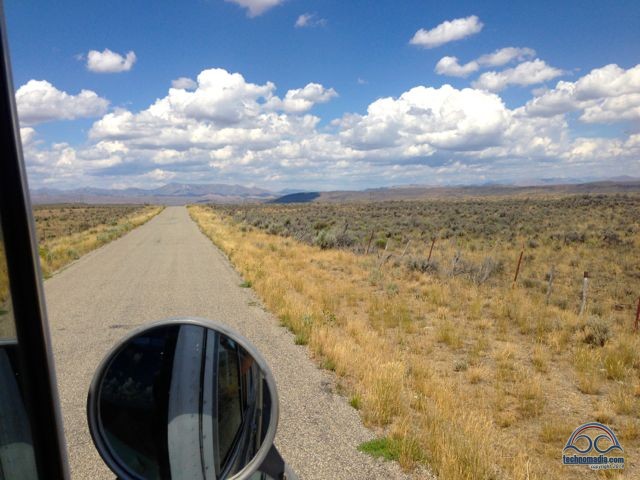
Just before pulling into West Magic, we saw a sign for Myrtle Point, one of the potentials. The direction seemed to align with where we had seen RVs parked on the satellite maps. We held our breaths and turned down the narrow dirt road that looked pretty well traveled and maintained.
At several points the road had choices to make – with no further signs. And certainly navigation apps were useless at this point. We did spot a vault toilet atop a peak, a sure tell sign of a semi-developed campground. We’d stop before each possible turn and look ahead, and choose the road that looked like it was heading towards that toilet… and that looked the most passable.
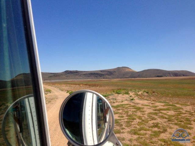
And then there we were, parked near a boat ramp and confirmation that the Magic Reservoir was very very low. In fact, the semi-developed camp area with the toilet that was once water front, was now quite isolated. And a peninsula that was once underwater was clearly more recently used for dispersed camping due to the presence of campfire rings.
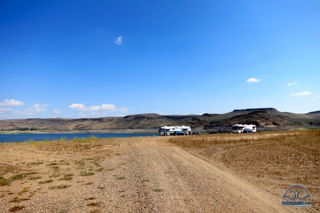
We parked our motorhomes, and walked around to decide our ideal landing location. We had the place to ourselves, and found a spot that made for several days of absolute isolated bliss.
Hooray for US Public Lands, hooray for satellite maps, and hooray for ditching technology and trusting instincts!
Finding these sorts of locations does take a bit of effort including research in advance that may not be easy to come by, and driving a bit off your course and possibly down non-passable roads. Not always ideal for an overnight stop, but when seeking somewhere to enjoy for a few days – it can be well worth the while for awesome free wild camping!

Thanks for the great article. In the article you said “At several points the road had choices to make — with no further signs. And certainly navigation apps were useless at this point.” Was that because you didn’t have internet service or the map apps didn’t have good coverage of that area? I often use the “Locus Map” Android app and download their paid (but very reasonable) statewide topo maps which include lots of local dirt roads, trails, etc.
Does the app show state land, such as state forests, or does it just show federal land?
Just Federal.
FYI, we find the DeLorme Atlas & Gazeteer state-by-state map books invaluable. Fairly recently Garmin, who purchased DeLorme in 2016, announced their intention to continue the paper publication of this series…phew! They also have an app called Earthmate that has a lot of the map detail of the A&G series downloadable by state. Very handy for exploring where no cell signal is present. We also have the inReach satellite comm device. It’s not cheap but it might save my life some day. Read their stories before your next back country hike! Be safe.
I know this is kind of an old article so hopefully I can still post a question.
I’m considering either going full time or rejiggering my life to accommodate longer term periods of solo RV travel with periods of stationary living. Up to now, I’m familiar with RV traveling in a two week vacation context. I mostly dry camp in USNF campgrounds because I like the implied security of either an onsite campground host or periodic supervision either by the commissionaire and/or forest service personnel.
You guys do dispersed camping on BLM and other government land. This intrigues me because of the lower costs, beauty and solitude. My question about this is how safe is your RV when you are away? Suppose you go to town all day or suppose you are doing a hike or day trip and are gone all day. Or suppose there is an emergency and you wind up in the hospital for a couple days or need to fly home for a few days or a week or whatever.
Can one be reasonably safe leaving their RV unattended in the desert for at least a day or perhaps longer?
Do certain areas lend themselves to more safety with respect to this vs. other areas?
As a baseline, I personally feel comfortable with leaving my RV unattended in a NFS CG for a day (so far never a need for longer than that). So I guess the question is your opinion of unattended RV safety relative to NFS CG camping. So any thoughts you (technomadia) or anyone else (general public) has on this would be great!!!
Thanks!
Our general rule of thumb is that if it doesn’t feel safe, we shouldn’t be there anyway. Each location has its own feel, follow your gut instincts.
Agreed on the gut instinct. I guess the issue is assuming that one has a gut instinct that a given location is a safe place to camp, whether that positive gut instinct applies only to camping and “being around” or whether it also applies to leaving an RV unattended. And I realize this may be too abstract a question such that there is nothing one can do but wing it. No right or wrong answer kinda thing.
Nonetheless I’m just curious about whether boondockers in general tend to say well if I feel safe enough to be in a particular location in the first place, it’s also safe to leave the RV unattended (or not).
Thanks for the response! I love your website!!!
If we don’t feel safe leaving our RV behind for a bit, why on earth would we want to stay there and endanger our lives too? That’s our theory. Whether we’re in campgrounds, RV Parks or out boondocking – we have comfortably left our RV behind for a day or two (or more) at a time.
Thank you for the article. Could you detail what you might do in such a place for up to 14 days? As someone who has never RVed, is from the NE and has never seen wide open country like this, while it looks very pretty and peaceful, i wonder if I’d go stir crazy. Thx!
Oh gosh.. going stir crazy is never even a thought for us. We love the solitude, wide open hiking (and in this location, swimming) and being able to just do our own thing.
Very good information. I also like to stop in at Forest Service stations to get detailed maps of the surrounding lands. I had no idea the Republicans were planning to screw up the entire notion of public lands, using a rider on a budget bill, no less. Morons.
You guys continue to provide a very valuable service to RVers of all shapes, sizes & configurations. Please keep up the good work! 🙂
You folks have done an outstanding job in bringing tips, tricks, and your adventures to us RV part-timers who seek the joy you spread with your wanderings or meanderings!
This latest article, on Magic Reservoir, puts the process in place to define the tools used to find places, off the grid, especially for those of us who have L O N G RV’s. A very compact article, describing the “way” to get to a great RV site, using available methods, various mapping tools, and available Websites.
Naturally, we follow the travels of folks like, “Gone with the Wynn’s”, who are in a hurricane traveling mode right now, and other full timers. Don’t forget about the excellent stuff/books/guides published by Suzi and Fred Dow with their “U.S. National Forest Campground Guide”. Extremely valuable resource.
Like Suzi and Fred, we use Arizona as our sunny base of operations. We lived in Oregon and Alaska for almost 30 years, and retired here to enjoy almost 365 days of sunshine, with the ability to hit the RV Trail, and visit the Northwest, or rest of the West, when the weather there is cool, pleasant, and tolerable. Don’t have to shovel sunshine!
Keep sharing your wonder adventures, and your technical expertise… We love it!
We will be getting your Public Lands app as soon as we hit the road. I’m always wishing I could see this information when looking at any map. One question for you — do you use the Days End Directory often? I wish there was a way to look at a sample before going to the expense of paying for membership, etc., first. Just curious how often you fall back on it.
Thanks!
Grace
We know many folks who use the directory quite often. We’ve only had it a few months ourselves, and honestly haven’t had much opportunity to use it ourselves. It comes in a PDF format – if it was a searchable map app, we’d use it far more often.
But it’s only $10, and worth having around. Joining Escapee’s for all their other benefits is well worthwhile.
GREAT post! Goes into wonderful detail on exactly how to do this. Love it!
As an additional resource for USFS specifically (Forest Service), the USFS publishes MVUM (Motor Vehicle Use) maps which tell you exactly which roads are open to dispersed camping and which are not. They are free to download or pick-up (at a local ranger station). So, for those looking to camp in our national forests I would add this as a step to your procedure.
Nina
Excellent addition Nina!
Here’s a link to a list of MVUM maps available online if anyone’s curious:
http://www.fs.fed.us/recreation/programs/ohv/ohv_maps.shtml
I know, how about we just come follow you all around! LOL Just kidding – I like that you’ve given lots of tools to use to help figure out where to go. For local things like that I also love the printed Gazatteer’s which can be found by State (heck they may even have them online – much like what your app brings up). Happy Travels!
The books and maps are handy. But do require you have them onboard in the first place. If you plan to boondock in one area quite a bit, definitely worthwhile having. But for those of us who just want to occasionally find a location and be a bit more whimsical in our travels, this method yielded some very pleasant results.
Love the satellite maps – even for less isolated spots! Thanks for a great post on finding prime locations in the wild, our favorite kind of place. Learned a lot – toilet navigation is definitely a new one 😉
Yes.. satellite maps come is uber handy. We also use them when selecting spots in campgrounds to reserve in advance – to give us an idea if we’ll have the privacy and views we most appreciate.
great post…can’t wait to find this place….
We loved it there.. definitely a score of a find!
I am so so SO glad to see this post. We just returned from South Dakota and my intention there had been to utilize the huge amounts of USFS lands to try out some dispersed camping, which we have done before in the deserts of the Southwest with great success.
Even armed with your Pulbic Lands app, we were still unsure as to where exactly we would be allowed to camp, if there were any associated fees and if there were, who to pay those fees to. To complicate matters, the Sturigs rally was in full effect and the law was everywhere on and off the highway. The last thing we wanted was to set up camp and then be told to move along.
We are conversant with BLM camping policies, but didn’t know if USFS followed suit, so we ended up campgrounding it, which was a bit disappointing for us. We simply weren’t sure where was … well, LEGAL.
It is really as simple as finding the green areas on the app and then double checking the USFS site? I know this seems like a total noob inquiry, but it was a huge concern for me. Thanks in advance. We had a splendid time in SD and hope to do it again boondocking in the future.
The USFS has similar camping policies as the BLM, but some different variances as well. And of course, each local division has its own rules to suit the use of the specific lands. If we were approaching a USFS potential boondocking spot, we’d use the same method above – use US Public Lands to target possible places to research, then a combination of web searches and satellite maps to scout out specifics.
Sean’s articles linked at the top of the article also lists a lot of the exceptions to the norm for both BLM and USFS.
One other thing to do if you are concerned about legality of a given area is to actually check in with some of cops and rangers roaming around. More often than not, they are very happy to help.
We’ve even heard of a cop actually escorting people to show them the best local hidden gem boondocking spot when asked nicely for a recommendation.
Stopping in at the local BLM or USFS HQ is also a great way to get tips.
– Chris